Postal Codes: The Silent Force Behind Effective Humanitarian Aid
Every decision during a crisis carries weight, especially when lives are at risk. During natural disasters, conflicts, or widespread emergencies, rapid and accurate aid delivery can mean the difference between life and death. Amidst the urgency and chaos, one simple yet often overlooked detail plays a crucial role in organizing relief efforts: the postal code.
It’s more than a sequence of numbers and letters. A postal code is a vital tool that helps ensure food, medicine, donations, and rescue teams reach the right people at the right time, wherever they are in the world.
Foundation of Rapid Crisis Response
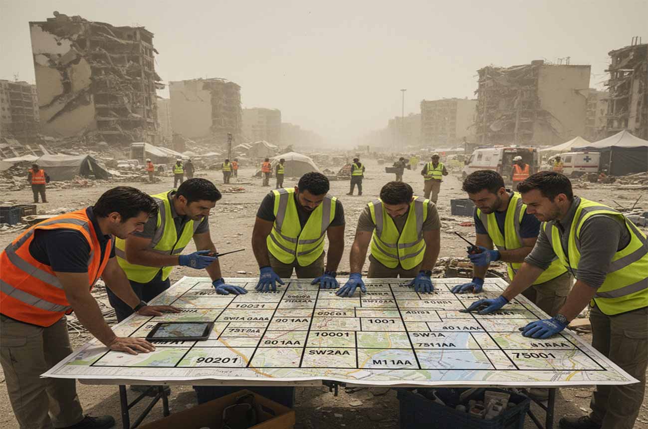
Every second counts during a crisis. Imagine a vast region struck by a severe storm, where thousands of individuals have lost their homes, food supplies, and sense of security. In this situation, identifying the exact locations of affected people becomes the first crucial step. This is where the postal code comes into play. Instead of searching blindly across a large and unfamiliar area, aid workers can rely on these codes to pinpoint the exact spots needing urgent attention. For those unfamiliar with what a postal code is or wondering, “How do I find my postal code?”, this system serves as a vital tool that connects people in need with the help they require, making relief operations faster and more precise.
Speeding Up the Delivery of Humanitarian Aid
Once priority locations are identified, the next challenge is delivering aid quickly and efficiently. Humanitarian logistics is one of the most complex operations in the world. It involves coordinating fleets of vehicles, managing storage facilities, and navigating areas where roads, electricity, or communications might be destroyed.
Postal codes serve as a bridge between warehouses filled with supplies and the people desperately waiting for them.
Imagine a central distribution hub in Europe sending aid to affected regions in Africa. Each box of supplies can be labeled with a postal code, ensuring that when the shipment arrives, it can be sorted immediately and sent along the correct route.
For instance, tents and blankets meant for flood victims in a remote Asian province can be directed quickly using the postal code system rather than vague descriptions or unreliable directions. This reduces confusion, prevents delays, and ensures essential resources reach those who need them most.
Smarter Logistics and Supply Chain Management
Efficient humanitarian operations depend on a well-organized supply chain. The goal is simple: the right supplies, in the right quantity, at the right place, at the right time.
Without a reliable system, some areas may face severe shortages while others are overwhelmed with excess goods.
Postal codes help aid organizations plan better by providing structure and clarity. By analyzing the postal codes of affected communities, relief agencies can estimate population sizes and their specific needs. This information helps determine where to establish distribution centers and how to design the most effective delivery routes.
Consider a food crisis affecting several towns in Southeast Asia. Postal codes can identify which towns fall within the same region or along the same road network. This enables aid convoys to cover multiple areas in a single trip, saving both time and transportation costs.
The result is a more balanced distribution of resources, preventing waste in some areas and scarcity in others.
Planning and Allocating Resources for Long-Term Recovery
Postal codes are equally valuable beyond the immediate relief phase. As communities begin to recover, they need more than just food and clean water. They require infrastructure rebuilding, education services, and healthcare support.
Using postal code-based data, agencies can assess the level of damage across different regions and design interventions tailored to each community’s needs.
For instance, if a region in Africa has villages severely impacted by drought, those villages can be prioritized for water system restoration projects based on their postal codes.
This approach not only guides where donor funds should go but also increases transparency. Donors can track exactly where their contributions are being used and what type of projects are being implemented.
Clear location-based planning builds trust while ensuring reconstruction efforts such as rebuilding schools or clinics are focused and effective.
Building Strong Data Collection and Analysis
In today’s data-driven world, accurate information empowers organizations to make smarter decisions and respond effectively.
Postal codes play a key role in data collection and analysis during humanitarian operations.
When surveys are conducted after a crisis, recording respondents’ postal codes allows researchers to detect patterns and trends. For example, if a disease outbreak occurs in South Asia, mapping cases by postal code reveals infection hotspots. Health officials can then target vaccinations and medical supplies to those specific areas, rather than spreading resources too thinly over a wide region.
Postal code-based data also helps track the long-term impact of aid programs. Relief agencies can measure whether a food distribution initiative successfully reduced malnutrition or if a water purification project decreased the rate of waterborne illnesses.
This level of detail is essential for improving future operations and ensuring best practices are applied consistently.
Strengthening Coordination Between Agencies
Crises often require the collaboration of multiple entities, government bodies, international NGOs, local communities, and volunteers.
Without proper coordination, efforts can overlap or leave critical gaps, leading to confusion and inefficiency.
Postal codes provide a shared geographical reference point that all agencies can use to organize their operations.
Take, for example, a large-scale crisis in East Africa involving several relief groups. One organization may handle food distribution for communities with postal codes starting with “123,” while another focuses on providing healthcare in areas with postal codes starting with “456.”
This clear division of responsibilities prevents duplicate deliveries and ensures that every aspect of the crisis is addressed.
By improving communication and planning, postal codes boost overall efficiency and help agencies work together more effectively.
Overcoming Challenges in Using Postal Codes
Despite their many benefits, using postal codes in humanitarian contexts comes with challenges.
Some regions lack comprehensive or up-to-date postal code systems. Remote rural areas or locations affected by conflict may have no postal codes at all.
Additionally, boundaries can change, causing confusion or misclassification.
To address these issues, humanitarian organizations employ several solutions. One approach is to use grid systems, dividing an area into smaller, labeled sections, even without official postal codes.
GPS technology also plays a crucial role. By recording exact latitude and longitude coordinates, aid teams can pinpoint locations with precision, regardless of postal code availability.
Local partnerships are equally valuable. Communities often help create improvised location-identification systems based on landmarks and descriptions, supported by satellite imagery and mapping software.
These adaptive strategies ensure that no community is left out, no matter how remote or hard to reach.
Lasting Impact on Community Recovery and Growth
The influence of postal codes extends far beyond immediate relief efforts. When used effectively, they lay the groundwork for stronger, more resilient communities.
Data collected through postal codes during crises becomes a valuable resource for long-term planning.
For example, if a region in the Middle East repeatedly experiences drought, past data can highlight which communities are most vulnerable. This information can guide development projects such as building wells, improving irrigation systems, or introducing climate-appropriate farming practices.
With precise data, organizations can allocate resources to create lasting change, helping communities become self-sufficient and better prepared for future challenges.
Postal codes may seem like a simple system of numbers and letters, but they hold immense power in shaping effective humanitarian aid worldwide. From rapid disaster response to sustainable rebuilding projects, their role in directing aid with accuracy and order cannot be overstated.
By ensuring that help reaches the right people at the right time, postal codes silently save lives and bring hope to communities across the globe.